
Last summer, in a blurry state of mind and with a need to leave Brussels and go anywhere but there, I looked on the map and figured out where the mountains were. That's how I ended up moving to Salzburg with a van full of stuff I'd gathered during my year in Europe thus far (having previously arrived from New Zealand with just a backpack).
Five days after I moved to Austria, I ran away to Portugal for three months, came back "home" to spend a few weeks here in the winter skiing as much as possible and then promptly disappeared again for four months this spring once again chasing the sun, adventure and a permanent sense of being on the go.
All that to say I've struggled to feel at home here in Salzburg - both because I feel I'm here because I can't be somewhere else and because I've really never given Salzburg a chance, what with my constant need to always be "elsewhere".
Well, let me tell you, this hike was what I was waiting for. This is why I moved here. This is my happy place. Sure, I still don't plan on spending most of my time here, but now I know that when I am here, I'll feel a little more at home.
The trail up to the Schafberg overlooking Wolfgangsee, Fuschlsee, Mondsee, Attersee and the exceptional mountain ranges and towns far flung across the region is quite a surreal one. You can hike from either Winkl near St. Gilgen or St. Wolfgang up to the summit. We hiked from Winkl through cool green forests, before emerging into alpine meadows with panoramic mountain views and plenty of cows (and poop to go with them!).
The hike is a steep one, covering 1250m in steady elevation high above the lakes. For this reason, they've built an iconic cog railway which you can ride (for a bit of a hefty fee) back down the mountain after you've sweated your way all the way to the top. I highly recommend hiking up to get the reward of the stunning view! At the summit, you'll find a restaurant and even a hotel, if you want to spend a little longer with these exceptional surrounds.
→ Follow along my Austrian adventures on Instagram @JanaInAustria!
SCHAFBERG HIKE DETAILS
When: June to October
Where: hike begins from Winkl (near St. Gilgen) or St. Wolfgang, both on the shores of Wolfgangsee
Difficulty: intermediate, but with a significant elevation gain
Length: from Winkl, the hike is 8.2km which took us just over three hours
Directions: so the trail isn't actually on Google Maps, but is perfectly mapped out on Maps.Me which I highly recommend - it's basically an offline version of Google Maps! From Winkl, follow the yellow signs for Schafberg marking Trail #20 all the way to the top. It's really easy to follow and, in the event a sign is missing at a crossroads, orange painted dots also mark the way. I suggest hiking all the way up and then taking the cog railway back down the mountain, else you're looking at a 5-6 hour 16.5km loop trek.
Bathrooms: yes, in St. Gilgen or St. Wolfgang as well as at the restaurant and hotel at the summit
Public Transit: yes, the 150 bus runs straight from Salzburg to St. Gilgen Hollweger. Transfer to the 156 bus (note this only runs every 2 hours on weekends so try to time your trip!) and ride it 2 stops to St. Gilgen Aich in Winkl. Alternatively, you can walk to Winkl from St. Gilgen which will add 45 minutes to your trek. Note that, on the way back down, the cog railway returns to St. Wolfgang (not St. Gilgen). If you're early enough in the day, you can catch the ferry from St. Wolfgang back to St. Gilgen and then catch the 150 bus back to Salzburg however, the last ferry is at 6pm which we missed. Luckily, a bus (last one 7:08pm) runs from St. Wolfgang to Strobl from where you can also grab the 150 bus.

The trailhead in Winkl

The view as you climb through the forest

The first view of the summit as you leave the forest and emerge into the alpine meadows

View of the hotel and restaurant on the summit


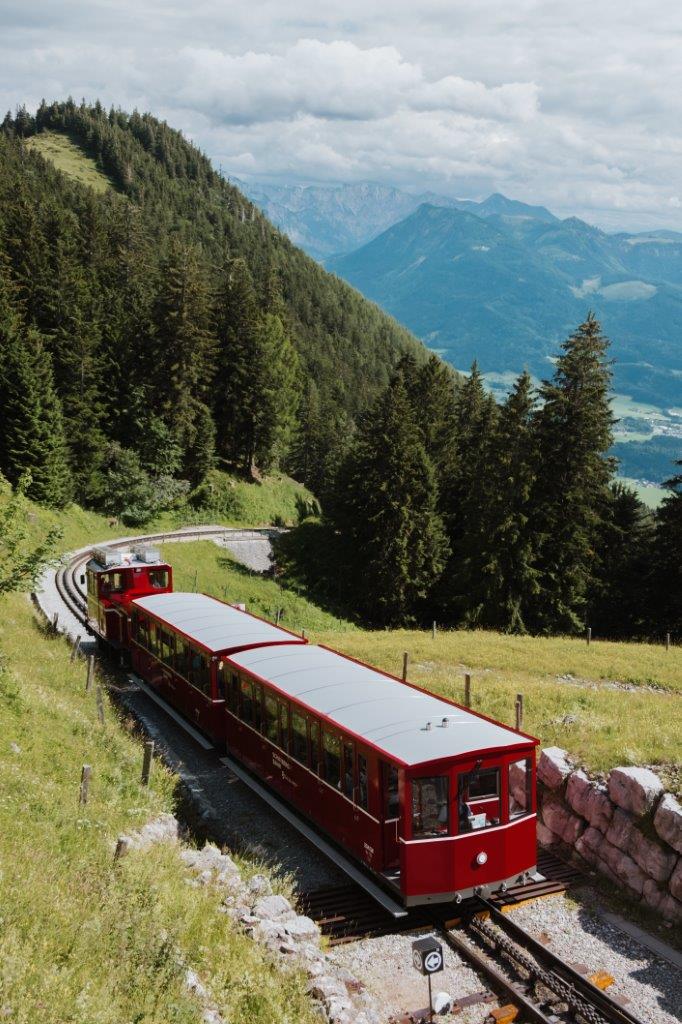
The little cog railway that runs up and down the mountain
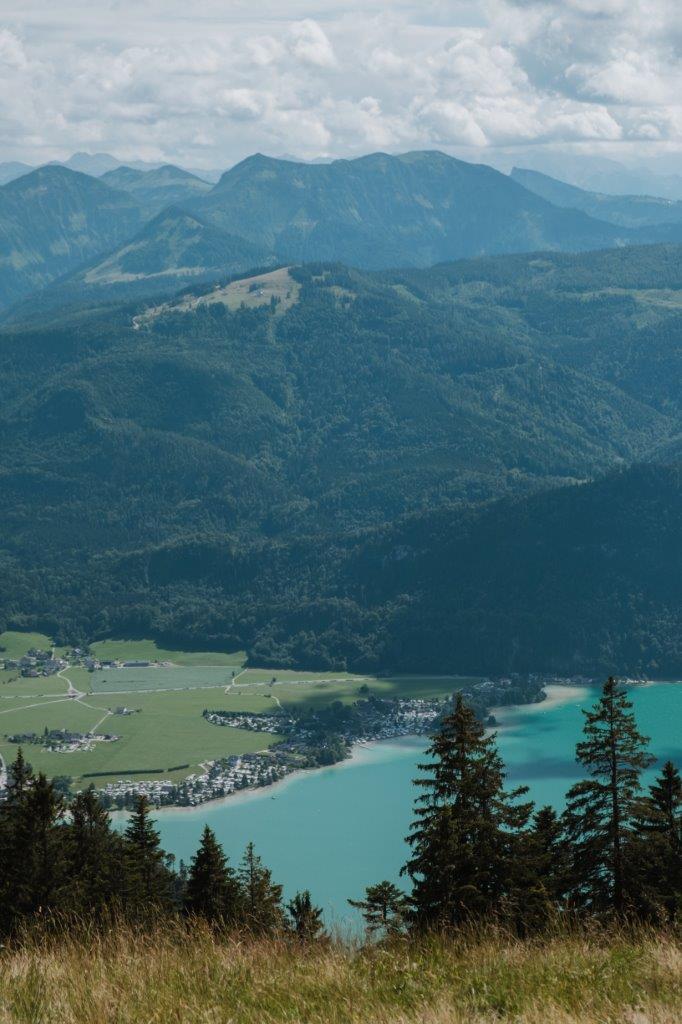
The view from the mid-way train station, Schafbergalm


Spot the train!

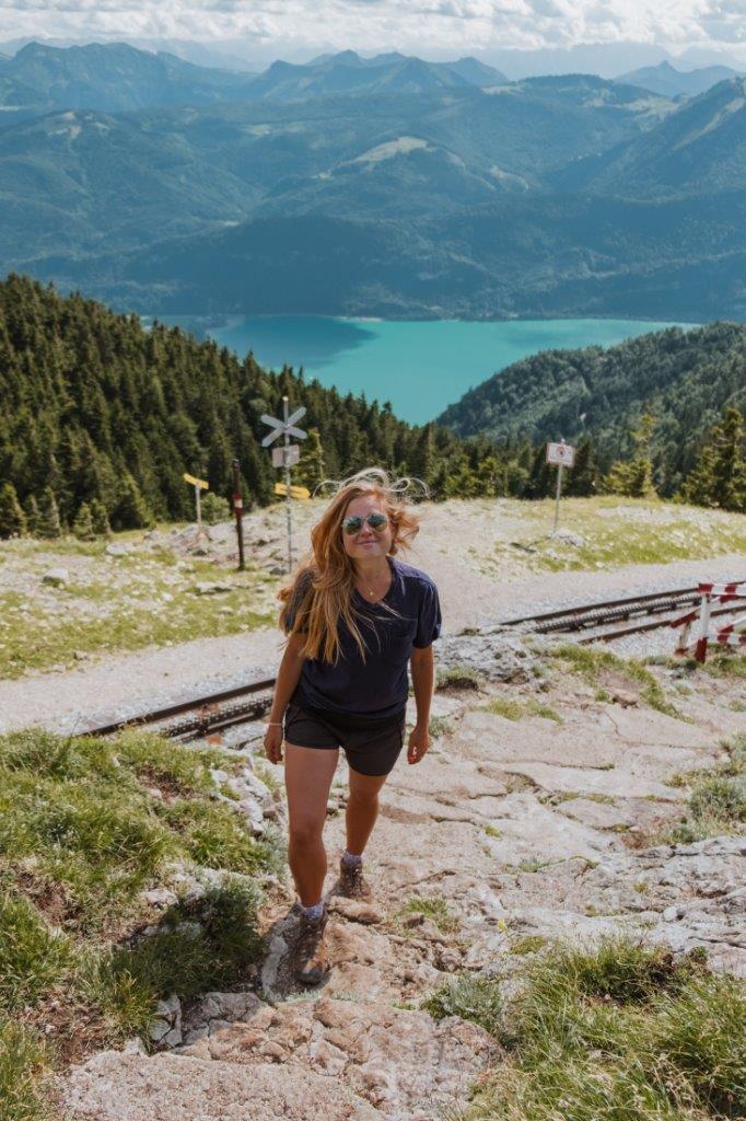


Looking down on St. Gilgen


The final push to the summit!

Summit views!

Mondsee from the summit

The cog railway down the mountain

Views of Wolfgangsee from the train
PIN THIS POST TO REFER BACK TO LATER!

Hi! I’m Jana, a Dutch-German-British-Canadian with a dream of seeing every country in the world. I am a storyteller, photographer and adventurer passionate about documenting and sharing my travels.
